
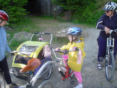
Family Guide
Family Rides
The Bill Chipman Palouse Trail is a 10' wide, 8 mile path along an abandoned railroad line, with 13 bridges crossing Paradise Creek. The trailheads are located at the Quality Inn in Pullman and at Perimeter Drive in Moscow. Parking in Pullman is available at the Quality Inn lot or on Derby Street near Koppel Farm. The Trail opened in April 1998 after 15 years of effort by members of the Pullman Civic Trust. Educational rest stops make the Trail pleasant and enjoyable. Users are encouraged to courteously stay to the right and travel single-file when passing others. Take water and appropriate clothing, as much of the Trail is open to the elements.
The Route of the Hiawatha is a scenic section of paved rail-bed from the Milwaukee Road. Depending on your enthusiasm, it is either a 30 mile round trip with 2000 feet of elevation change, or 17 miles of level and downhill dirt track with a shuttle bus ride to regain your 1000 foot elevation loss. The shuttle connects the West Portal of the Taft Tunnel (Roland) and the lower trailhead (Pearson), located beside the North Fork of the St. Joe River on Forest Road 456. Riders who park at the East Portal, located ~2 miles off I-90 at the Taft Exit in Montana, 5 miles from Lookout Pass on the Idaho border, must ride back to their vehicles from Roland.The route takes you through nine cavernous tunnels and over seven high trestles, past waterfalls, ridge top vistas and interpretive signs. A trail use fee applies, along with the optional shuttle fee. Helmets and proper lights are required for bikers.
During the peak season, July 1 thru September 6, the trail, trailheads, and facilities are open every day from 8:30 AM to 6:00 PM (Pacific Standard Time). During the early and late seasons, daily operations close at 5:00 PM.
The Day Use Pass for the Route of the Hiawatha is $8 for people over 13, and $4 for those between 3 and 13. Children under 3 are free, and all children must be accompanied by an adult.
Directions:
Drive to Spokane and from there; take I-90 past Wallace and Lookout to the Taft exit #5. At the exit you will make a couple of quick S-turns (right off ramp, left past large gravel piles, right over small white bridge, left, right) to Rainy Creek Road #506, proceed south on this road (away from I-90), over Roland pass (seven miles from I-90) to west Portal and Roland.
The Centennial Trail is, for the most part, a 12-foot wide, paved trail running all the way from Nine Mile Falls (northwest of Spokane) to the Idaho border, where it becomes the Idaho Centennial Trail and continues another 23 miles to Coeur d'Alene. Motorized vehicles are prohibited the entire length of the trail. However, be prepared to deal with city traffic intermittently for a couple of miles as the route passes through Spokane a few blocks north of the downtown area.
The portion of the trail running east of Spokane to the Idaho border is virtually flat, closely paralleling the Spokane River, with I-90 never more than a couple of miles away, but largely unnoticeable. In contrast, the section running west of town to Nine Mile Falls is quite hilly and passes mostly through the tall conifers of Riverside State Park.
A few rules for cyclists have been established to keep the trail safe and sane for a wide variety of users, but nothing that should excessively cramp anyone's style: no alcohol, maximum speed of 15 mph, yield to pedestrians, ride single-file when pedestrians are present and otherwise no more than two abreast.
There are many access points along the way; contact the Friends of the Centennial Trail (509-624-7188) for additional information and maps. You can also call the Spokane Visitor Information Center at 590-747-3230 (toll free number for out-of-area inquiries is 800-248-3230) for details.
The Trail of the Coeur d'Alenes bike path follows the Union Pacific Railroad's right-of-way from Mullan, a mountain mining town near the Montana border, to Plummer, a town on the prairie near the Washington border. About 72 miles of paved path takes you from high mountain splendor, through the historic Silver Valley, into the chain lake region, along the shore of Lake Coeur d'Alene, over a bridge to Heyburn State Park and then on to the Coeur d'Alene Indian Reservation: an adventure for the entire family!