
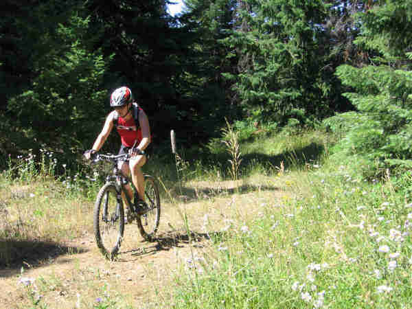
Mountain Bike Rides
Mountain Bike Rides
Beacon Hill
Hell’s Gate State Park
Moscow Mountain
Where: Go through
What: Dirt road that goes up to the top of the mountain and a lot of different trails that come down. Not all the trails come down to the same place you started, so be careful when choosing your way down.
Length: About five miles to the top by the road. Distance down depends on the route.
Difficulty: Mostly moderate depending on the trail.
St. Joe National Forest
Where: Go through
Laird Park
Where: After Harvard, go a few miles, then turn right at the Laird Park/Camp Grizzly sign. At
What: Trail
Length: 10.2 miles to the Moose Creek Reservoir, same distance back to the trailhead.
Difficulty: Moderate to Difficult
White Pine Campground
Where: After Harvard, go a few miles past the
What: There is a network of trails in the area ranging from a one mile hike to an eighteen mile loop. A trail guide is at the bottom. It is mostly up going away from the campground, then down coming back.
Length: Varies from a one mile loop to an eighteen mile loop. Check the map at the parking lot for which trail to take.
Difficulty: Moderate to More Difficult
North/South Ski Bowl
Where: Go past White Pine Campground and take the first good right turn. You should be near Meadow Creek, which is a logging road. You can also continue along S.R. 6 all the way to North/South or start at White Pine and bike on trail 26.
What: There are lots of trails in the ski area that are circular or connect with the White Pine trails. Lots of varied terrain.
Length: Depends on the trails you take and how far you go.
Difficulty: Depends also on the length and the trail.
Palouse Divide Road
Where: Go to North/South Ski Bowl, the
What: This is a dirt road which can ride in either direction along the top of the ridge
Length: Depends on how far you ride along the road.
Difficulty: Moderate to easy
Colville National Forest
Frater Lake Trail No. 150
Where: From
What: The trail is a loop that is mostly flat. The trail will end at the same parking lot.
Length: 4.9 mile loop
Difficulty: Easy
Wolf Donation Trail System
Where: From
What: Flat trail loop through undeveloped area. Additional trails are also being constructed.
Length: One mile loop
Difficulty: Easy
Umatilla National Forest
North Fork Asotin Trail No. 3125
Where: From Clarkston, take Highway 129 south to Asotin. Head south along Asotin Creek. Take first two rights, then go 3/4 mile and take a left for about five miles to the end of the road.
What: Trail follows the North Fork of Asotin Creek for seven miles, then climbs to Pinkham Butte.
Length: 11 miles
Difficulty: More Difficult
Meadow Creek Trail No 3123
Where: From Highway 26 after Colfax, take highway 127 to Pomeroy, then head west on Highway 12 for about 22.5 miles. Turn south on the
What: Trail follows along Meadow Creek for three miles, then climbs along logging roads.
Length: 4 miles
Difficulty: More Difficult
Elk River Area
Where: From
What: Mostly dirt and gravel road, some trails. Roads vary, so ask at the Huckleberry Heaven Lodge for the best places to ride.
Length: Depends on how far you go.
Difficulty: Easy, mostly flat terrain.
Additional Information
These are just the places that are closest to Pullman/Moscow. For additional places to ride, check in the National Forest files or in the mountain biking file.
For those of you who want to explore area trails in more detail, the Moscow Area Mountain Bikers Association offers the Mountain Bike Guide To Hog Heaven: Moscow Mt, North-South Area, McCroskey State Park, by Jim LaFortune. This handy guide is now in its third printing and although it was first published in 1995, updates for all the trails in the guide are published on the Web site (http://users.moscow.com/bike). Current trail conditions and route changes due to logging are available on the site as well. The guide is easy to read, fits well in a pack or jersey pocket and is available for only $9.99!
Mountain Biking Code of Conduct
- ALWAYS WEAR A HELMET
- No bicycles are allowed in wilderness areas - check trail maps before riding in national forests.
- Most trails are multiple use. Hikers and horseback riders have the right-of-way over bikers. Speak to people before you approach them.
- Always ride in control and anticipate others around turns.
- Respect the environment - stay on designated roads and trails, avoid creating ruts and cutting off switchbacks.
- Do not litter - pack out what you pack in.
- Stay off private property or other areas prohibited to bikes.
- Do not disturb wildlife or livestock.
- Carry water, a first aid kit, and a bike repair kit when riding.
- Remember that people judge all mountain bikers by your actions.